Tuesday, December 22, 2015

Gorgeous scenery marks Washington's North Cascades National Park

North Cascades National Park
Photo by National Park Service
If you want stunning scenery, there's no better place to find it than North Cascades National Park. It's just been named one of the top 16 places to visit in the world in 2016.  It was the only destination in the United States to make the list. 
North Cascades National Park is located in Washington State, stretching from the border with Canada south to near Twisp. The park is bisected by SR Highway 20, one of the most scenic drives you'll ever make. Many years ago, when I lived in Omak, Washington, I sometimes took Highway 20  when I went to Seattle in the summer. A longer drive, but the scenery made it worthwhile.
 
The route was filled with high mountains, Liberty Bell being one of the most photographed, and beautiful glacier-fed lakes. The park has more than 300 glaciers, the most of any place in the United States outside of Alaska.  The scenery must be equally as beautiful in the winter, but I wouldn't know. Because of heavy snows, the Washington Highway Department closes the highway in winter from Ross Lake on the west side of the mountains to Lone Fir Campground on the east side.
 
Wild flowers and wildlife abound here, among them deer, cougars and black bears. If you see one of the more than 1,500 black bears, the National Park Service wants to know about it and asks visitors to fill out a bear monitoring form.
 
Camping and hiking are popular activities here; hiking, especially, since the park is close to the Pacific Crest National Scenic Trail.


Monday, December 21, 2015

Three PNW shops make some of USA's best doughnuts

Warning: Reading this article may cause you to gain weight!

Three West Coast doughnut shops were among 29 nationwide that were singled out by Food & Wine on CNN as having the best doughnuts in the United States.

Top Pot Doughnuts, Seattle, was singled out for its oversize donuts and fritters as well as their flavors and decorations.

Portland's entry was Voodoo Doughnut, so named because one of their doughnuts is shaped like a voodoo doll, filled with red jam, and a pretzel stick shoved through it.

Portland's second entry was Blue Star Donuts, which also makes doughnuts in Los Angeles and Tokyo. They were singled out for using a French brioche dough and the unusual toppings and flavors.

The majority of those named to the list were located on the East Coast.

Wednesday, December 16, 2015

Anatone: the shrinking Washington community

Anatone, Washington
Anatone, Washington, may have been a thriving community at one time, but today it resembles a ghost town, with dilapidated buildings lining both sides of Highway 129.

It sits high on the windswept prairie above the Snake River, and is surrounded by wheat fields, the major agricultural crop on the prairie.

The community was founded in 1878 by settlers by Daniel McIvor and Charles Issecke, and named for a Nez Perce woman.

Its population is shrinking. Anatone had more than 200 residents in 2000; now it’s down to 38, with cats, dogs and horses adding another 48 inhabitants, according to the community’s Facebook page. Anatone doesn’t have a newspaper but it does have a newsy Facebook page.

Anatone has no services, so travelers on Highway 129 will need to take care of this in Asotin, about 30 miles to the north or wait until Oregon. Limited services are available just across the border, with major services available farther south in Enterprise, Oregon.

Snake River from Highway 129
What Anatone has is stunning views of the Snake River as the road descends into Asotin and forest views in Oregon.

Tuesday, November 10, 2015

Columbia County Courthouse, Dayton, Washington

Columbia County Courthouse
The Columbia County Courthouse in Dayton, Washington, is a stately structure as befits its grandee dame status among the state’s courthouses. County officials claim it is the oldest working courthouse in the state, having been completed while Washington was still a territory.

The county seat, Dayton, was founded in 1871, but it wasn’t until 15 years later that construction of the courthouse began. Until then, trials and county business were conducted in rented hotel rooms.  Construction costs came in at $38,069, under the budget of $40,000/ Construction began in 1886, with the county using it for the first time in 1887. Washington became a state in 1889.

An ornate cupola tops the building. The building is accented by bronze statues of a Blind Justice and eagles. Two Civil War cannons stand in the front yard. The Blind Justice statues were melted for scrap metal during World War II.

The courthouse, located at 341 East Main Street, has seen some remodeling over the years. It was placed on the National Register of Historic Places in 1984.


Saturday, October 31, 2015

Idaho railroad trestle carried trains for 80 years

Railroad trestle at Lawyer's Canyon in Idaho
Railroad trestles that were once used by trains carrying people and goods in western Idaho can still be seen today along U.S. Highway 95 between Lewiston and Grangeville.

The picture above shows one of many trestles built in 1908 to cross Lawyer’s Canyon and Camas Prairie gorges.  This trestle was 1,500 feet long and 296 feet high. The trestles were mostly wood with a metal structure.

The trestles were used by Camas Prairie Railroad, a joint venture of Union and Northern Pacific railroads, for 80 years.

Saturday, October 10, 2015

Oregon's Wallowa Lake popular with campers, recreationalists

Wallowa Lake
Wallowa Lake is nestled among the scenic beauty of the Wallowa Mountains in northeastern Oregon. The area is sometimes known as the Oregon Alps or the Switzerland of Oregon.

The 3.7 mile long lake was formed by glacial action. Its waters are pure and clear, allowing boaters to see fish swimming on the bottom.

The lake and its facilities, including campgrounds, boat launches and lodging, are located at the end of the road that comes from nearby Joseph. It has a day use picnic area and floating docks where boaters can alight for picnics. The lake and some of the facilities are operated by the Oregon State Parks system.

The lake sits at more than 4,300 feet in elevation, which means it sometimes freezes over in winter. The water warms up enough in the summer for swimming and water skiing.

Deer rest beside the highway to Wallowa Lake on a winter day.
 Wallowa Lake is popular with wildlife visitors as well. It’s not uncommon to see deer roaming the camp-ground, sometimes resting under travel trailer awnings to keep cool on hot summer days. A pair of eagles nests on the south shore of the lake. Visitors also may see elk, coyotes and bears; t higher elevations they may spot mountain goats.

This family oriented recreation area is located about 4-1/2 hours drive from Boise and six hours from Portland.

Monday, September 21, 2015

Washington's Garfield County Courthouse gleams in sun


Garfield County Courthouse, Pomeroy, Washington
The Garfield County courthouse in Pomeroy, Washington, is an interesting structure, portions of it looking almost castle-like.

Made of brick and stone, it stands out from the other stone bounty courthouses built in that era because it’s painted a gleaming white. The official architectural style is Late Victorian.

The courthouse was built in 1901 after the previous wood courthouse was destroyed by fire a year earlier; the fire also destroyed much of this small city’s business district. Built at a cost of $18.783, the courthouse was constructed primarily of local products: stone from the Snake River region, Bricks made locally and roof shakes from the nearby Blue Mountains.

A statue of Justice stands atop the clock tower. It is one of only 20 Justice statues nationwide where Justice is not wearing a blindfold. The statue lost its arm in a windstorm in 2006, with the arm being replaced.

The courthouse has been on the National Register of Historic Places since 1974. A courthouse restoration project, which cost $2 million, was completed in 2011. The project’s scope was to stabilize the aging building and restore its historic character that was lost over the years.

Pomeroy was named the county seat in 1882. Garfield County, created in 1881, is named from US. President James Garfield who died that year. Pomeroy is the county’s only city.

Pomeroy is located in eastern Washington.  The courthouse is located on Pomeroy’s main street, also known as U.S. Highway 12.

Wednesday, September 16, 2015

Stagecoach stop reverts to meadow status

Sled Springs
Sled Springs once offered respite for weary travelers headed west to Elgin, Oregon. These travelers arrived on wagons, stagecoach or horses beginning sometime before the turn of the 20th century and continuing until about 1925.

It also was a railroad logging camp, inhabited by about 300 people, after that. Today it is a quiet meadow, part of the Wallowa-Whitman National Forest.

Sled Springs is located on the highway that connects Asotin, Washington, with Enterprise, Oregon. The highway is called 129 in Washington and 3 in Oregon.


Tuesday, August 25, 2015

Lewiston, Idaho, square honors polio victim who never gave up

Brackenbury Square in Lewiston, Idaho
There are two good ways to travel Highway 12 east through Lewiston, Idaho. The first is to take an immediate right turn after crossing the Blue Bridge from Clarkston, Washington. It loops around under the bridge and you follow the Snake River by the "Wave" canoe statue and by the confluence of the Snake and Clearwater rivers. This is the signed route. It’s more fun to stay on the road that takes you through the tree-lined Main Street of Old Lewiston.

This one-way street will take motorists by Brackenbury Square, named in honor of a Lewiston resident who overcame adversities to thrive in this town. The entrance to this small park is marked by a statue of children playing in a fountain. Take time to enjoy the serenity of this small square; be warned, though, on-street parking sometimes can be difficult to find.

Mary Case Brackenbury grew up in Lewiston’s Hotel Idaho that was owned by her parents. Using the name Launi, she became a professional Polynesian dancer on the vaudeville circuit. In 1953, after dancing at a March of Dimes fundraiser, she was stricken with polio and placed in an iron lung. After a lengthy recovery, she came back to the Hotel Idaho to run the hotel, raise three children and care for her mother. Her husband, Rod Brackenbury, died from wasp stings on a 1957 hunting trip.

When people saw her children taking lessons in international dances, they, too, wanted to learn those dances. Soon he teaches and students were giving costumed presentations throughout the region, with proceeds going to the National Polio Foundation. Mary was named a March of Dimes mother of the year; she died in 1970 from complications of polio.


Sunday, August 9, 2015

Lenore, Idaho. tram hauled grain, not people

Spring grain field above Lenore
The awesome scenery along U.S. Highway 12 east of Lewiston through the Clearwater River canyon hides what’s on the other side of the hills: fields of grain, thousands and thousands of acres of a variety of grains.

Getting that grain to market was a challenging task for early farmers, who had to drive wagons full of grain down a long steep hill. That changed in 1898 when the railroad was extended from Lewiston to Lenore, about 25 miles east. A tram was built to carry buckets of grain down 1,600 feet from the prairies above to a new freight stop on the other side of the Clearwater.

The tram system was completed in 1903, with the gravity-activated tram hauling about 100,000 bushels of grain annually until 1938, when a fire destroyed the tram system.

Friday, July 31, 2015

These are bike racks? You're kidding!

Bull moose sculpture
Beware of the moose as you drive through Old Town in Lewiston, Idaho. The moose are peaceful and not afraid of traffic on the corner of Fifth Avenue and D Street.

But the bull moose and calf are not what they seem. Made from steel pipe, they're actually bicycle racks.  We drive by them probably once a day and have never seen any bicycles there, though the moose are 'walking" on the sidewalk across from the Lewiston City Library.

These sculptures are just some of the public art located throughout Lewiston. The moose came to town in 2012 under sponsorship of the Lewiston Urban Renewal Agency.


Thursday, July 23, 2015

Dwoshak ia a pretty dam place

Dworshak Dam
Dworshak Dam isn’t just another pretty dam, though one would be hard pressed to find a dam in a prettier setting.

Located in rural Idaho, Dworshak Dam stands 717 feet tall, making it the highest strait-axis concrete dam, not only in the United States, but in the whole Western Hemisphere.
Dworshak reservoir
The dam spans the North Fork of the Clearwater River just a short distance from Orofino. It is visible from U.S. Highway 12. Behind the dam is a 54-mile long reservoir that is popular with boaters and fishermen.
Operated by the Walla Walla District of the U.S. Army Corps of Engineers, construction on the dam started in 1968 as a flood control project. The dam began generating power in 1973. The complex includes log handling facilities as well as a fish hatchery that is located nearby.

Saturday, July 4, 2015

Be sure to wave as you drive into Lewiston, Idaho

Lewiston, Idaho, is a friendly city, where townsfolk greet strangers with a hearty “how are you?” or wave as they drive by. It’s no surprise, then, to be greeted by a wave as you enter the city from Washington State on the other side of the Snake River.

This wave, made from dozens of canoes, is one of the coolest statues you’ll probably ever see. .Dubbed the “Cool Wave,” this fantastic outdoor artwork has an equally fantastic mural as a backdrop.  Together they present a powerful image to motorists who drive across the Highway 12 Blue Bridge from Clarkston, Washington, into Lewiston.

The wave, which some people think resembles a swimming fish per the background mural, is designed from 44 used canoes, all painted silver. It was created by Christopher Fennel, an Alabama engineer turned artist. His creation cost the City of Lewiston $99,500, and was part of a $900,000 project to enhance the east entrance to Lewiston.

The sculpture is 23 feet high. Directly behind it is a 27-foot tall, 150-foot long mural that depicts fish swimming as wide waves radiate out from the center. One end of this acrylic on concrete mural wraps about the building. The mural was painted by brothers Rolf and Peter Goetzinger.

See more photos of this unique  artwork below.


Tuesday, June 23, 2015

Vehicles shine at Dayton, Washington, car show

Dayton's annual Show 'n Shine
All roads lead to Dayton, Washington, the third weekend in June for the community’s All Wheels Weekend, one of the biggest car shows in eastern Washington.

Car owners have been wowing crowds since 1995 with everything from vintage Model Ts to the newest muscle cars on the market today. Some pretty cool motorcycles also can be seen at Saturday’s big Show ‘n Shine. Hundreds of cars line both sides of this small community’s Main Street, while hundreds more people show up to ooh and aah over these carefully restored vehicles.

Through traffic on U.S. Highway 12 is rerouted for several blocks on Main Street, so visitors can gawk in safety.

The show ‘n shine is the big event, Other events in the three-day weekend include a demolition derby, sock hop and lawn mower races.
 
See more car show photos on my Youtube channel.

Thursday, June 4, 2015

Rest in peace at Lenore

Lenore rest area
The Lenore Rest Area is probably one of the prettiest rest areas you’ll ever see.


Well-tended lawns. Tall stately trees providing shade for picnic tables. The sounds of the Clearwater River rushing by. All combine to give this rest area a sense of peace and serenity.

Throw in a little history and what more could you ask for?

Near the main restroom is an historic sign that says this was used as a steamboat port during the Clearwater Gold Rush of 1861. The port was caked Slaterville after Seth Slater who founded the port and community of about 50 residents. It was home to two stores, two houses and a saloon. After a steamboat crashed here, the port was replaced by a new port in Lewiston.

A few yards away, around a bend in the rest area’s road, is another marker, this one devoted to Indian housing. An Indian village once was located on this spot, where Indians lived, fished and hunted or 10,000 years.  Just below the bank is one of the best fishing holes on the Clearwater River; a road leads down to the river so today’s fishermen can try their luck.
 
The rest area is located on U.S. Highway 12 between Lewiston and Orofino, Idaho.


Tuesday, May 26, 2015

Lewiston served briefly as Idaho's first capital

Idaho's first capital building located at
12th and Main in old Lewiston
This one is for trivia buffs: what was the first capital of Idaho?

Lewiston, a city at the confluence of the Snake and Clearwater rivers, was picked as the first capital of the newly created Idaho Territory, with the legislature meeting here for the first time in 1863.

Its tenure was short-lived, however, as the legislature voted to move the capital to Boise on December 7, 1864. It wasn’t until 1866, however, that the move became official, since some challenged the legislature’s decision since it was not made in a regular session. Boise has been Idaho’s capital ever since.
 
Today, Idaho’s ninth largest city is the capital of Nez Perce County.

Saturday, May 16, 2015

Missionaries to Nez Perce buried on reservation


Visitor center mural
A must-stop for tourists traveling U.S. Highway 95 between Grangeville and Lewiston, Idaho, is the Spalding Visitor Center a few miles from Lewiston.

The Spalding Visitor Center is located in a serene setting alongside the Clearwater River. It is part of the four-state Nez Perce National Historical Park that is operated jointly by the National Park Service and the Nez Perce Indian Tribe. The park includes numerous sites in Idaho, Montana, Washington and Oregon that have historical significance to the Nez Perce tribe.

The visitor center shows a 23-minute film about the Nez Perce and what the tribe is doing today to preserve its cultural heritage. It also has a small, but excellent, collection of tribal dress, implements and other items used by the tribe over the centuries.

Located on the Nez Perce reservation, this site takes in the mission established by Henry and Eliza Spalding who came here following the massacre at the Whitman Mission in Walla Walla, Washington.  The couple is buried at the Lapwai Mission Cemetery, which is still an active cemetery,

The tall headstone belongs to the Spaldings
There’s a picnic area across from the cemetery. Just before crossing a wooden bridge to get here stands the house used by the superintendent of the Indian Agency. A trail through the original town site starts here. Not too far away is the Watson’s General Store, which specialized in merchandise, such as beads and canvas for tepees, the Indians needed, but also carried general merchandise.

The site also offers several easy walking trails throughout this section of the park.  It’s also a good place to go bird watching, where great blue herons, osprey and kingfisher, among other bird species, can be seen.


Park celebrates 50th anniversary

Nez Perce cultural day
Nez Perce National Historic Park celebrated its 50 anniversary May 16, 2015. Part of the day's activities included a cultural day hosted by the Nez Perce tribe at the Spalding visitor center's picnic area. Tribal members in their native regalia rode horses around the main tent; they were accompanied by four men singing and beating a drum.  At another tent, a woman explained about the roots, berries and other plants that were used in traditional foods and healing.

You can view a short video of the opening ceremony on my Youtube channel.

Thursday, May 7, 2015

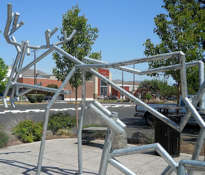
Art adorns shoulders of Lewiston highways

Driving into or out of northeastern Lewiston, Idaho, offers an unexpected delight: metal sculptures on the highway shoulders.

The sculptures can be found at the junction of U.S.highways 12, which takes motorists east to Missoula, and 95, which heads north to Moscow and Coeur d'Alene.

The sculptures have a Western theme, as you can see in the ones I've  posted below.


Tuesday, May 5, 2015

Lewiston. Idaho: pretty in pink

Pink dogwoods are in bloom in Lewiston
Lewiston, Idaho, a town on the Snake River, truly blossoms in the spring when dogwood trees begin to bloom. Pink blossoms are everywhere, with a few white dogwoods thrown in for good measure.

Dogwood trees are everywhere, in city parks, lining city streets and filling the yards of homes. Indeed, the largest trees can be found in the yards of older homes and seem to be Lewiston's version of the mighty oak.

Thi natural beauty does not go unnoticed, as Lewiston celebrates its dogwood festival every April. The celebration centers around arts and culture, with a fun run, quilt show and other activities.

Lewiston is named after the faed explorer, Meriwether Lewis of the Lewis and Clark expedition. right across the river is Clarkston, named for his co-explorer, George Clark.

Sunday, April 5, 2015

Kennewick Demonstration Garden blooms in spring

Almost any time of the year is a good time to stroll through the Kennewick Demonstration Garden. I particularly enjoy walking through the garden in spring because all the blooms and blossoms are so pretty.

Here are some photos I took on a recent stroll through the demonstration garden, which showcases plants in a variety of settings. The garden is located on Union Street next to the Mid-Columbia Library in Kennewick, Washington.


Monday, March 30, 2015

Driving through Oregon's Ukiah-Dale Scenic Corridor

Ukiah-Dale Scenic Corridor
Eastern Oregon isn’t all sagebrush and grain fields. It’s lush forests and bubbling rivers such as can be found in the Ukiah-Dale Scenic Corridor.

This scenic drive takes motorists through forests ponderosa pine, Douglas fir and larch. This section of U.S. Highway395, which stretches from Canada to Mexico, is curvy as it goes through the mountains, alongside the north fork of the John Day River. Near the Ukiah end of the corridor, there’s a 27-site campground.

The river offers excellent fishing for trout, salmon and steelhead, while a nearby wildlife area offers plenty of opportunity for elk hunters.

The corridor is administered by the Oregon Department of Parks.

 
North fork of John Day River


Sunday, January 11, 2015

Yellowstone, Bend, Oregon, on top places to visit

Yellowstone National Park and Bend, Oregon, are in the New York Time's 52 places to visit in 2015. The newspaper publishes the list annually. The No. 1 spot went to Milan, Italy.

Yellowstone was No. 4 and Bend,No. 30.

Yellowstone National Park

the newspaper selected Yellowstone because of the $70 million program to update existing accommodations and add anew lodging  around the Canyon Lake visitor center.

Yellowstone's Grand Canyon
The Times frequently uses high-end lodging as a reason to visit a place. I would disagree with this, especially at Yellowstone. People visit Yellowstone to experience the wilderness, to see wild animals and outstanding physical features such as geysers (think Old Faithful) and the Grand Canyon of the Yellowstone. For what it's worth, my feeling is if people expect all the five-star luxury of a Manhattan hotel, that's where they should stay. When you visit the Great Outdoors, you should expect to rough it, even if it's only somewhere between tent camping  and a luxury hotel.

Bend, Oregon

Located in central Oregon, Bend is just a few hours' drive from Portland, the state's largest city. It's a pretty drive, past forests, sparking steams and mountains. The newspaper picked Bend for the list because it's smack dab in the middle of the outdoors, and  crafted beers and ciders. Bend also has 400 miles of mountain bike trails and world class seeking at nearby Mount Bachelor.

Om our last visit to Bend, we enjoyed a stop at the High Desert Museum, just a few miles south of Bend on Highway 97.